Sample this: In a few years, people living in busy, congested neighbourhoods like Velachery, Mylapore, Tondiarpet will have safe and vibrant streets with spaces demarcated for walking, cycling, sitting, playing and street vending. Yes, this is how the Mega Streets project will reportedly transform our city. Six consultants have been roped in to redesign selective locations in Phase I of the project.
But what is the project all about? Here is what we know about it till now.
What is the Mega Streets project?
This project aims to transform all the arterial and sub-arterial streets in the neighbourhood with three guiding principles:
- Ensuring seamless mobility for all users including pedestrians, cyclists, women, children, elderly and the differently-abled.
- Enhancing livability, ensuring happiness and the well-being of our citizens with seating for the elderly, playing equipment for children, adequate lighting for safe access for women at nights, and shade for comfort.
- Well-managed utility: Ensuring the resilience of urban infrastructure, with no road cutting necessary for the next 30 years
The wide footpaths, cycle-sharing systems and last-mile connectivity will enable the women, children, elderly, and people from all cross-sections of the society to move around safely.
The project consultants will draft a master plan for redesigning the streets in each neighbourhood connecting them to city-wide networks of walking and cycling.
Which are the areas selected for implementing the project?
A neighbourhood approach is followed in the Mega Streets project instead of choosing streets across the city. In the first phase, six neighbourhoods are selected and six consultants are appointed for each package.
Following are the details of the first phase of the project:
| S.No | Location details | Consultant firm | Total length (in kms) |
|---|---|---|---|
| 1 | Anna Nagar | HCP Design Planning and Management Pvt Ltd | 13.081 |
| 2 | Tondiarpet – George Town – Thiruvottiyur | Oasis Design Inc | 25.814 |
| 3 | Nungambakkam | Jana Urban Space Foundation | 12.244 |
| 4 | Mylapore | Arya Architects | 30.486 |
| 5 | Velachery | IBI Group India Pvt Ltd in consortium with CUBE | 15.299 |
| 6 | Adyar | ArchitectureRed and Urban Design Collective | 20.284 |
Vidhya Mohankumar, architect and urban designer, spoke to us on behalf of Chennai-based consultants for the Adyar package – architectureRED + Urban Design Collective – and informed us that the project has been slightly delayed because of the lockdown. On-ground mapping was not possible since March, but surveys have been completed now and work is back on track.
The consultants were asked to identify a 5-km patch of the road which will be developed in the first phase. In Adyar, they have selected Taluk Office Road, West Canal Bank Road and Canal Bank Road to work first.
“Since a Metro line is on the works on LB Road, we chose other stretches for the first phase that would not be hampered by the alignment. Our approach is environmentally sensitive and respects the blue and green cover of Adyar and our phasing is a ‘one neighbourhood at a time’ concept,” she added.
How can residents living in these neighbourhoods participate?
Due to the pandemic, public consultation is planned to be held online. The conceptual designs proposed by the consultants will be uploaded on the website for the residents to share their feedback and suggestions. It is anticipated that the designs would be ready in three months.
How are the streets chosen for the project and what were the aspects studied?
The officials studied the city and came up with a list of roads that meet the following parameters:
- Streets along existing/proposed transport corridors and with related hubs such as railway stations, MRT station, bus terminal/stand, etc. to enhance last-mile connectivity and multi-modal integration.
- Streets with high visitor intensity for work, education or recreation trips. For instance, zones around markets, institutions, public spaces, schools, central business districts, religious places, prominent landmarks, important heritage zones or tourist destinations, etc are considered.
- Streets that have the potential to transform the image of the city at a national/international level because of its character, location and association with citizens. This will also attract a large number of tourists.
- Greenways network around water bodies and other ecological hotspots.
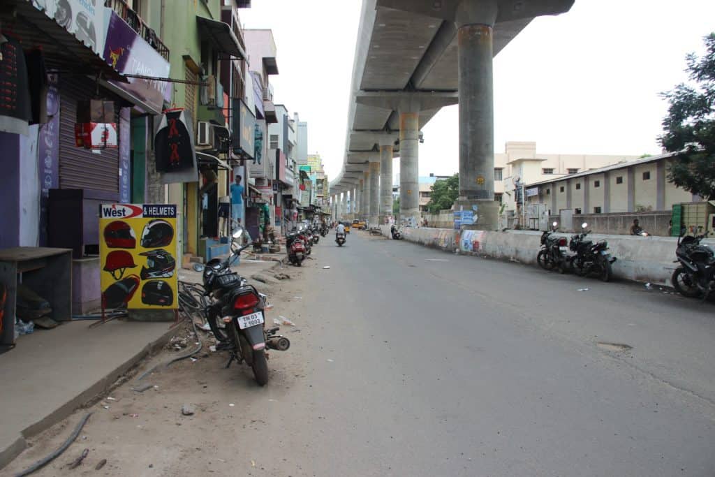
- Special projects such as spaces under flyovers and above subways, streets integrated with parks and reclaimed lands, etc.
- Streets with existing NMT infrastructure would be assessed for liveability and recommendations of components like street furniture, shade, lighting, etc., to improve liveability wherever needed should be made. Similarly, origin-destination locations and other information identified from cyclist surveys will help create cycle networks. The walking and cycling networks should include intersection redevelopment to ensure integrated street design.
Creating walking and cycling infrastructure for the city
The consultants will study and map the existing and upcoming transport and urban infrastructure plans (including transit corridors, existing NMT infrastructure etc,) along with street hierarchy, accident spots and notable landmarks.
The consultants will do on-site verification, conduct surveys with cyclists and focus group discussions for understanding the on-ground realities and hear the concerns of different stakeholders.
After shortlisting the streets, the consultants will prepare a vision for the neighbourhood and detailed design for streets within the identified study area of 68 sq km.
What will be surveyed in the streets from the six neighbourhoods?
- Topography Survey: In the topography survey, all the above-ground utilities such as electricity overhead lines, utility and feeder boxes, and all other utilities should be recorded.
- Study of land use and activity: The consultants will compile land use information to help inform street design decisions. Places that generate activities adjacent to the streets, such as shopping areas, theatres and housing developments will be identified.
- Survey of pedestrian and cyclist facilities: The consultants will document the quality of existing pedestrian facilities on all streets in the study area.
- Survey of pedestrian and cyclist movement: Surveys shall be carried out to assess NMT user flows at important locations in the study area. The survey shall be from 06:00 to 22:00 on a normal working day. The consultants will record the number of pedestrians and cyclists moving along the road on important corridors.
- Parking study: A parking study must be carried out to identify parking patterns, demand and occupancy rates, both on-street and off-street in public spaces. If the street falls under the city’s parking management system, the consultant is required to consult GCC to coordinate the design of parking slots with the Parking Management Plan.
- Study of street vending and related activities: The consultants should study vending activities in the identified streets to generate inclusive design. The survey also should capture social gathering spaces and other activities found in the streets. It will decide the inclusion of street furniture and other elements.
- Landscape study: The consultant must make note of all the trees and shrubs in the study area. The survey should note the type of trees and their current state. The consultant will coordinate with the Parks Department in GCC to collect this information. This will inform the placement of additional trees of native species in such a way that the final design results in a well-shaded street.
What are the elements that citizens can expect in the new street design?
Following are some of the additional elements that citizens living in the six neighbourhoods can see after the project is completed:
- Dedicated cycle tracks (if the corridor falls on the cycle priority network)
- Dedicated pedestrian footpaths
- Pedestrian crossings, including formal speed table crossings as well as median breaks that serve as informal crossing locations
- Trees of native species to provide shade for pedestrians and cyclists as well as decorative landscaping, including compensatory afforestation for the trees removed as part of the project
- Bus stops and Paratransit stops
- Traffic calming elements, where needed to reduce vehicle speeds.
- Physically demarcated on-street parking areas
- Street furniture, including benches, stools, tables, and other seating arrangements
- Signage locations
- Pedestrian refuge islands
- Carriageways, ensuring that the width remains uniform between intersections
- Utility access points
(Inputs sourced from Draft Request for Proposal)
Why not AMBATTUR above points?
Why there should not have Metro
I.e Nearest is Anna Nagar
Why show favouritism to Anna Nagar
Sorry typographical error
To read as
(1) Requested for New design in AMBATTUR
(2) Requested for Clean Metro water
through Tap for COMPLETE 600053
(3) Requested for Metro near AMBATTUR OT
Detailed article gives insight into this mega user friendly infrastructure development project! Glad to note that lot of thinking, planning and coordinated activities are in progress! Wish the endeavour of the projects as well as its utility to be a grand success?
Would you know which is the full stretch for the West Canal Bank Road?
But how about streets and roads which are made non-useable due to repeated digging and irresponsible closing?